The trail map
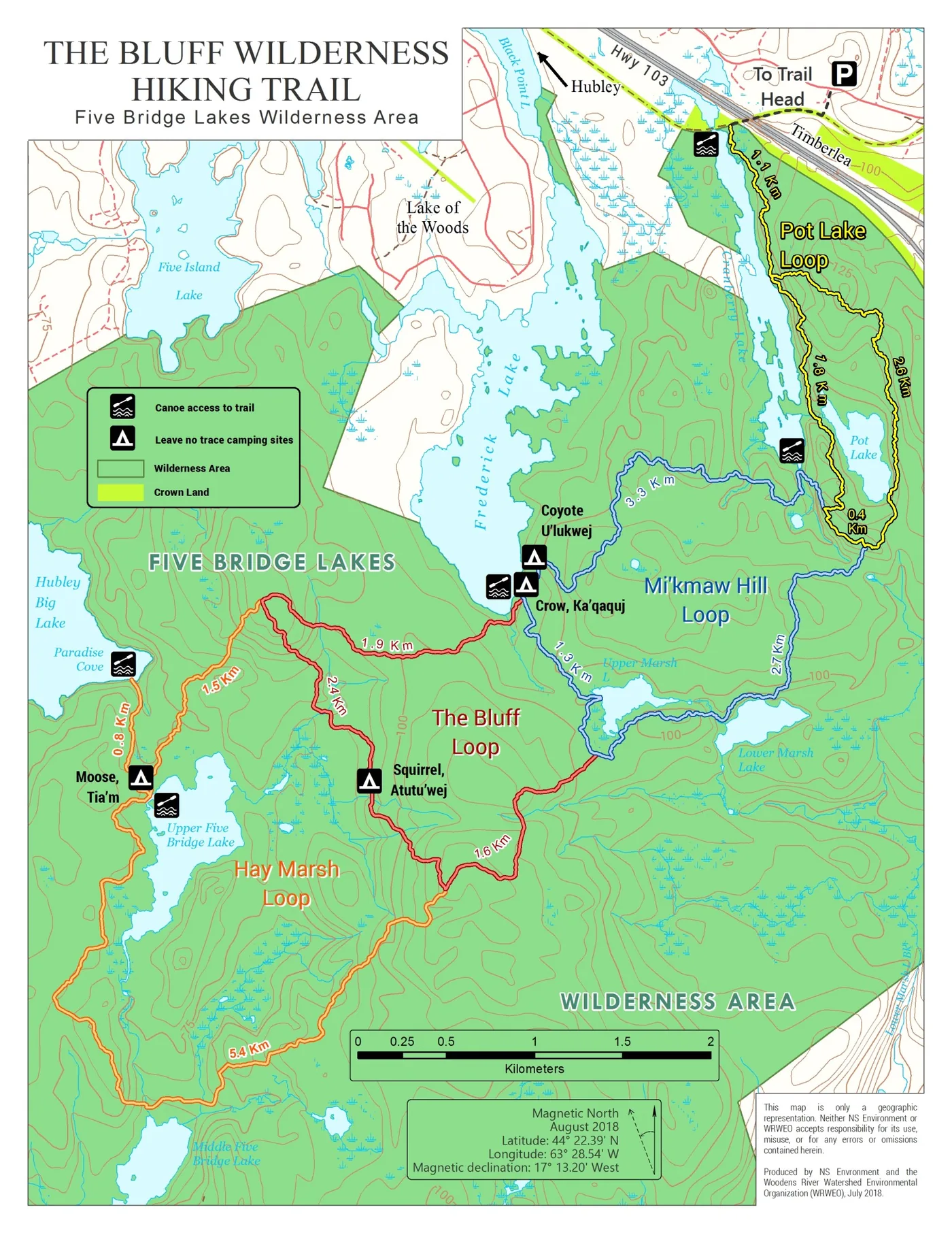
The official map of The Bluff Wilderness Hiking Trail is produced by Nova Scotia Environment and WRWEO. It shows the four colour-coded loops, the lakes, the canoe access points, the Leave No Trace educational camping sites, and segment distances along the route.
Distances
Two sets of figures are published, because they measure different things. The map distances are taken from the printed map. The GPS distances are shorter because GPS readings do not account for changes in elevation, and this trail has plenty of those.
| Route | By map | By GPS |
|---|---|---|
| Parking lot to trailhead (one way) | 0.7 km | 0.6 km |
| Out and back via Pot Lake Loop | 8.7 km | 6.7 km |
| Out and back via Mi'kmaw Hill Loop | 17.4 km | 14.0 km |
| Out and back via The Bluff Loop | 23.4 km | 18.4 km |
| Out and back via Hay Marsh Loop | 29.0 km | 22.9 km |
Add 1.4 km (map) or 1.2 km (GPS) for the return walk between the parking lot and the trailhead. The four-loop system as a whole, counting the connecting segments, covers more than 30 km — the figure usually quoted is 32 km.
On the “12 km, seven hours” figure
The trailhead signage and WRWEO's older material describe the first two loops as about 12 km taking a full seven hours. The measured table above gives 17.4 km by map and 14.0 km by GPS for the same walk. Plan on the longer figures and the seven hours: the time is the number that matters, and this is slow ground.
Plan your excursion according to what you can cover comfortably during daylight hours, but carry enough to survive overnight in case of an emergency. Cut the day short if it is taking longer than expected.
GPX track
-
Full Bluff Trail GPX track
The complete four-loop system as a GPX file, for loading into a handheld GPS or a phone app before you lose signal. Treat it as a backup to the paper map, not a replacement for it.
-
Canoe access points and portage routes
Every put-in and portage marked as points and GPS routes, for reaching the outer loops by water.